
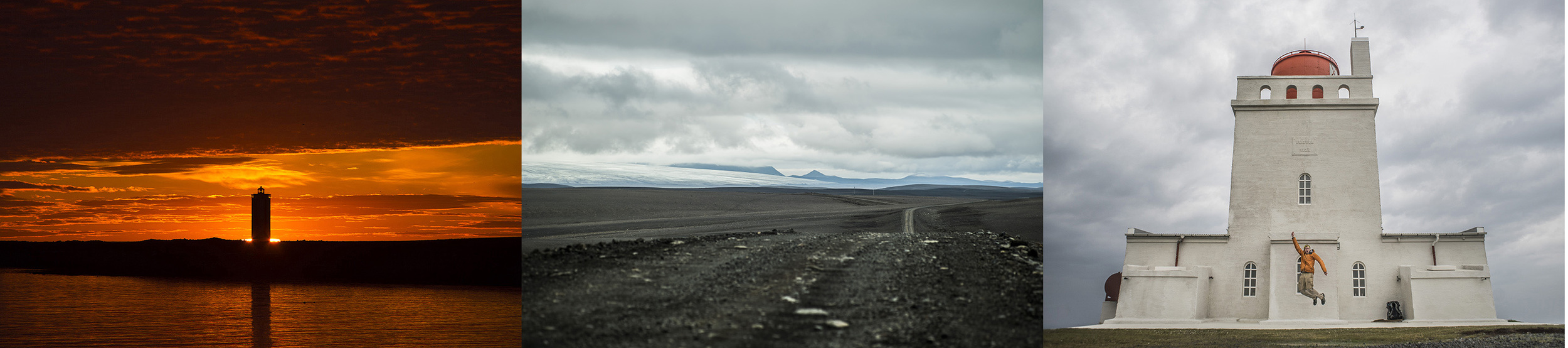
Hraunhafnartangi to Dyrhólaey
The whole thing started three years ago. Alex Page and I were making travel plans for the next summer. After multiple travel ideas, Alex found a wealth of information on past cross-country traverses of Iceland. He proposed loosely following in the footsteps of Jonathan Ley, an adventurer who detailed his experience on his page phlumf.com. I had long been interested in Iceland, and when Alex brought up the walk across Iceland from the Northernmost point to the Southernmost point, I was game. We spent the next year planning, getting ready to make the trip in the summer of 2014.
In March, Alex dropped out for personal reasons. By then I had a strong desire to attempt the trip, so in May 2014 I flew alone to Iceland to try. I wound up being unsuccessful, unprepared with insufficient food, navigation tools, or understanding of the territory. Upon returning from the trip, I began making plans to try again. At this point, I began defining the traverse as a walk from lighthouse to lighthouse, the northernmost lighthouse being Hraunhafnartangi, the southernmost Dyrhólaey. While these two points are not the absolute northernmost and southernmost points in Iceland, they are each within 1km from the extremes and made for more exciting start/end points.

Mountains in the Fjallabak Nature reserve viewed from the southern edge of the highlands.
Fast forward to summer 2015. I graduated college, worked at Philmont in June and July, came home for 6 days to visit family and friends, then shipped myself back to Iceland to reattempt the traverse. This time I had more food, better navigation, and more time. I let ICESAR know where I would be and came later in the summer for lighter snow conditions.
It was a success!
I don't want to provide and in-depth trip report detailing day-to-day experiences for this post, so I'm going to talk more in general about the walk. Here's a route map with some trip info.

Blue dots are camping spots, some are labelled with notable locations.

In 2014, I came upon the northernmost lighthouse at 2:30am when the sun was just beginning to rise behind it, an incredibly beautiful experience. This time, it was midday and quite foggy. I couldn't see it clearly until I was a few hundred feet away.
The northern sections of trail reminded me of my time in Iceland the year before. I had visited this area, seen the roads before. This time, the birds were gone, night came and went, and I was filled with excitement for the unknown ahead of me.
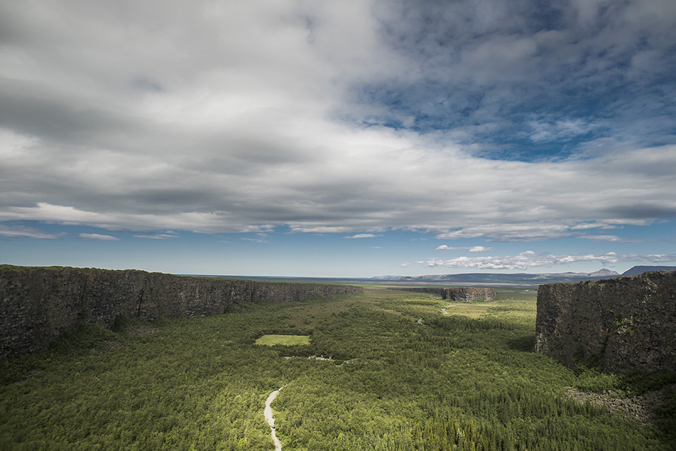
The cliffs of Asbrygi from the southern rim.
I had previously visited Asbyrgi and Dettifoss but had never seen the area between them. the trail along the Jökulsá á Fjöllum river passes by some of the most incredible lava/basalt formations on the island, It was a treat to see so much incredible geology stuffed into one day.

Midges around Mývatn are no joke.
About 30 km before Mývatn, I somehow rolled my ankle. I walked for another five days on the ankle, but (what a surprise) it didn't improve. I put the trek on hold just above the highlands and laid down for a week to let the ankle heal. I was worried I wouldn't be able to continue the trip, worried if I left the trail I wouldn't come back. These fears were eased when, after a week, the ankle pain and inflammation improved significantly and I was able to press on.

I spend a night in this trailer, just off the side of the F26 in the middle of the desert.
It is a strange feeling to be alone in the middle of a desert. The landscape of the highlands is barren, black, and windy. As most who visit this area experience, there are often storms that include a full menu of discomfort: very strong headwinds, stinging sideways rain, dust and dirt picked up by the wind delivered directly into my eyes, and a deep, constant cold.
Icelandic history tells of outlaws and loners who took up residence in the highlands. If they survived, they often carried a legendary status, and I can see why. Staying in that region alone for weeks, months, years would make one more than a little crazy. The constant wind gets into your head, rattles your brains a bit. It steals things too (eg. my ground cloth).

I was forced to have layover days twice on the trip simply because the weather was so bad. Thankfully, there are emergency shelters out in the middle of nowhere. I don't think my tent would have survived some of the storms I was able to wait out in the safety of a hut.
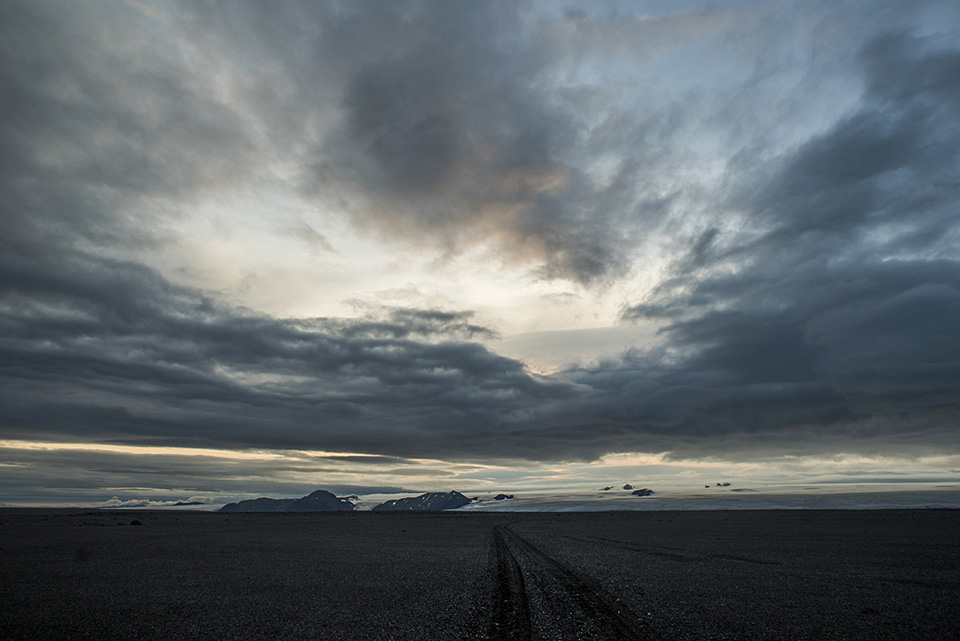
Deep in the middle of nowhere, my map called this set of tire tracks a "road."
This solo walk was without a doubt the toughest challenge of my life. I wasn't completely sure I would make it through until I actually finished. Very often I would have problems with my own morale. I would sit down, put my back against the wind, and consider whether the walk was really worth it. I would feel like hitching away, wishing never to walk the route again. I'm happy I was able to see the journey through, I know if I didn't I would have found myself back on the route for another attempt in a few years.

One of the most famous views on the Laugavegur trail.
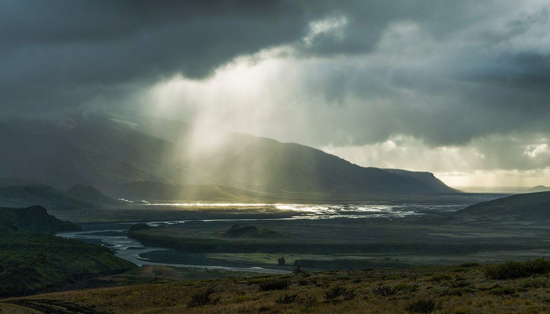
The south-central region, home to the Fjallabak Nature Reserve, Laugavegur trail, and pass to Skogar, contains some of the most beautiful scenery in the entirety of Iceland (and some of the least predictable weather).
Nearing Thorsmork.
The Lauguavegur is often found on international trail top-ten lists, and I can certainly see why. Every second of this trail is filled with amazing views. The environments found in this 55km section of the hike were incredibly varied. I feel like I had the entire trek's scenery compressed into two days with tons more piled on top. There was a little taste of the highland's black desert, even some new friends!

Sunset in Thorsmork's valley basin.
Upon reaching Thosmork, I felt the trip coming to a close. I was a day away from the coast and at the end of the climactic Laugavegur trail. I felt sad to have such an incredible experience come to a close but excited for the next adventure.

2km from Skogafoss, almost to the coast.
When I reached the top of the pass to Skogar, I could see the ocean 13km away in the distance, the sun's reflection shining on its surface. It was an emotional moment to know that the end was in sight. Well, almost the end. The lighthouse was still about 30km from Skogar.

Made it!
Reaching the final goal of the trek was an odd experience, not as cathartic as I expected it to be. Other tourists were parked at the lighthouse, enjoying the view with their loved ones, strolling leisurely along the cliff side. Without someone else there at the finish line with me, it almost didn't seem real. I wanted to share the what I was feeling with someone, but no one was there to feel it. I reached the lighthouse, touched it, walked around it for a bit, took a few photos, then left, hitched back to Reykjavik for my plane the next day.

From Iceland I flew to Ibiza, Spain to meet up with some good friends on vacation. It was a completely different environment, strange to be warm, relaxed, and surrounded by friends so quickly, but wonderful all the same.
The traverse was an experience I will never forget. I look forward to doing more long-distance walks in the future and recommend an Icelandic traverse to anyone experienced enough to do so. A huge thanks goes out to everyone who helped me during the trip, those who picked me up while hitching to and from the trail, those who asked if I was ok if they saw me during the walk. I am especially thankful for my friend Finna Sigurðardóttir who was absolutely incredible in assisting me whenever I needed her help. I could not have done it without her.
I am traveling in Spain until November. I will keep moving, keep learning, keep making. May that taste for adventure never run dry.
Tucker